
Product
Everything that matters, at a glance
From the global map to an event near you: less searching, more useful context.
- Map and list
- Four sources
- Event filters
- Personal settings
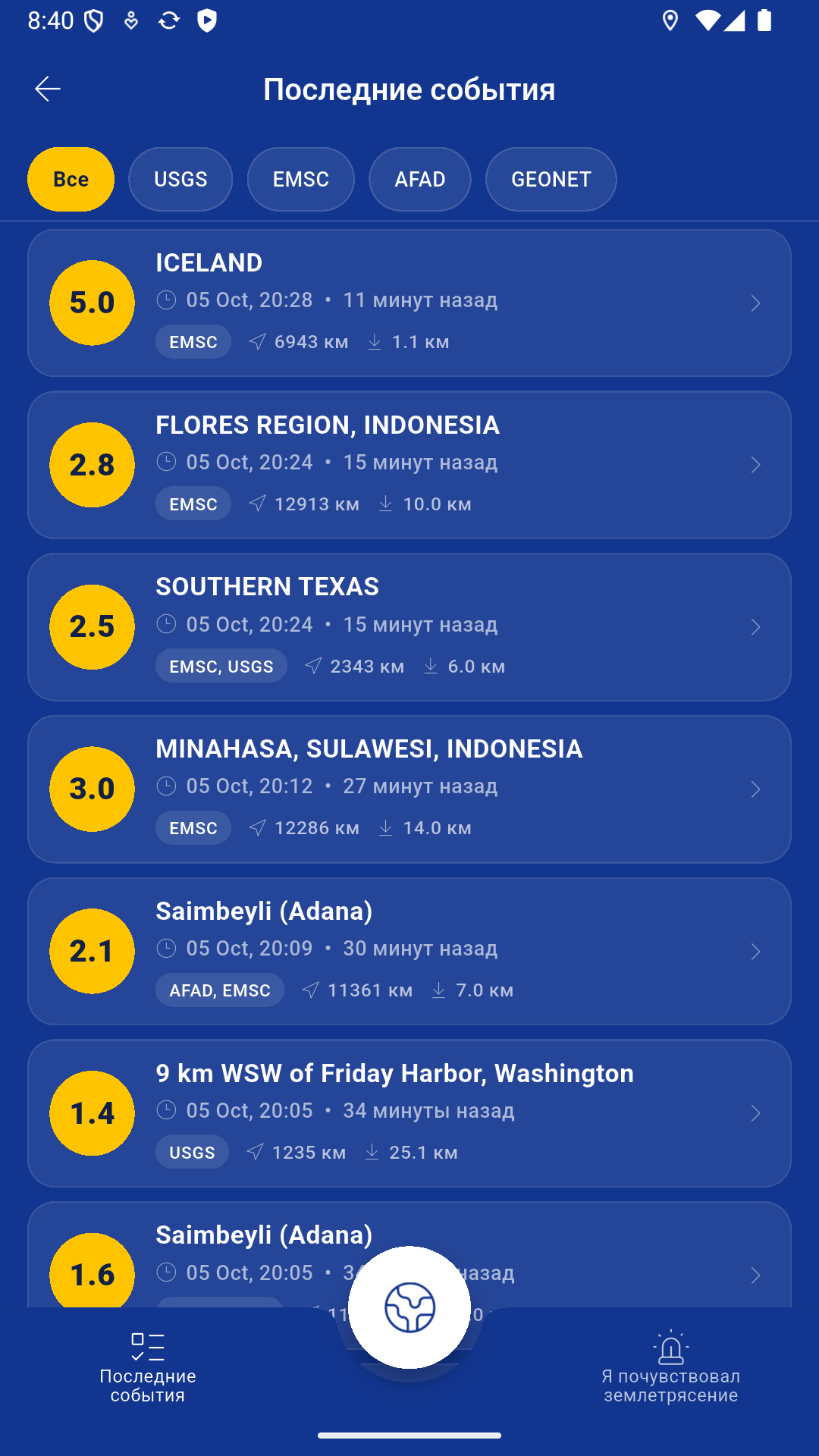
The situation at a glance
Open the map, understand the situation and move to the event that matters—without specialist catalogues or technical tables.
Every event can include:
- magnitude and scale type;
- event time and latest update;
- depth and coordinates;
- distance from the selected location;
- the network that published the record;
- related estimates from other sources when available.
The big picture first. Details when you need them.
Circular markers show magnitude directly on the map. The event stream makes consecutive earthquakes easy to compare, while source filters narrow the view to USGS, EMSC, AFAD or GeoNet.
Multiple data sources
Earthquake Alerts brings together open publications from several seismic services. Records close in time and location can be grouped into one event to reduce duplicates while keeping every source visible.
Fewer irrelevant notifications
Settings include minimum magnitude, geographic radius and data sources. Important revisions—such as a changed magnitude or location—can be treated separately.
Push delivery requires device permission and server infrastructure. Until that system is live, neither the app nor this website promises guaranteed delivery.
“I felt it” reports
A visual scale turns sensations into simple observations, from barely noticeable movement to stronger effects. No specialist knowledge is required.
Submission and publication are being introduced gradually. Until server submission is connected, prepared report data remains on the device.
Important limitation
Earthquake Alerts does not predict earthquakes and cannot replace official warnings or emergency services.